Favourite pictures of NewZealand
Finally after two weeks at home, I got through with my favourites beyond all the million pictures I took in 15 months in New Zealand. I hope you all enjoy looking at them and share it.If you have question about something, don't be shy - just ask ;)


 |
| Caitlins - Curio Bay |
 |
| Clutha Gold River - Spot near Roxburgh |
 |
| Clutha Gold River - Spot near Alexandra |
 |
| Aoraki or Mt. Cook (3724 m) |
 |
| Akaora Inlet |
 |
| Christchurch Cathedral September 2017 |
 |
| Pinders Pond near Roxburgh |
 |
| Bluff Hill |
 |
| Stewart Island |
 |
| Moeraki Boulders |
 |
| Sandfly Beach near Dunedin |
 |
| Dunedin Rail Station |
 |
| Caitlins - Nugget Point |


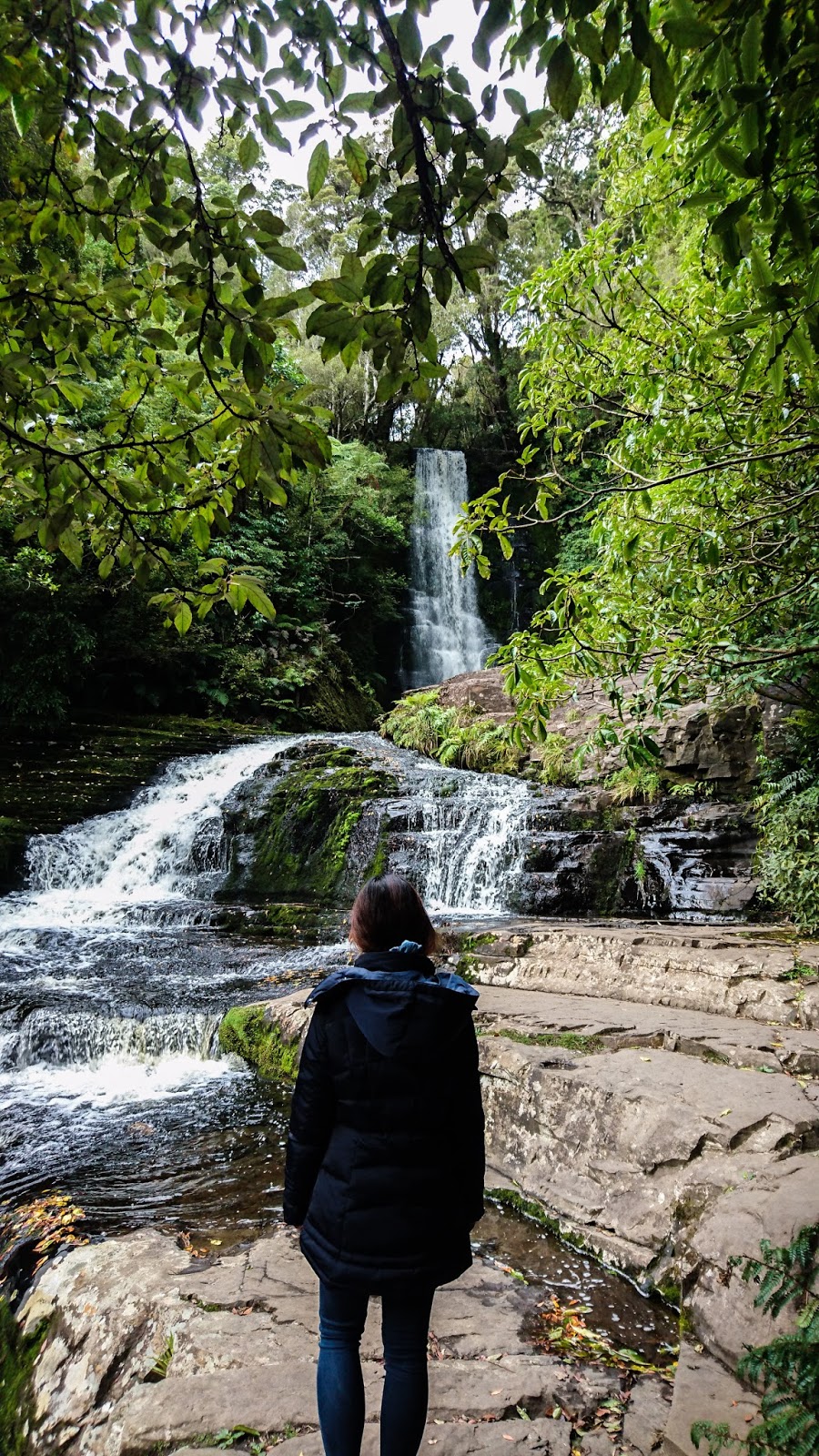 |
| McLean Falls (22m) |
 |
| Stewart Island - Rakiura Track |
 |
| Stewart Island |
 |
| Stewart Island |
 |
| Monkey Island |
 |
| Eglinton Valley on the way to Milford Sound |
 |
| Track up to summit of Ben Lommond (Queenstown) |
 |
| Lake Monowai |
 |
| Queenstown Gondola - Look over to the Remarkables |
 |
| Lake Marian |
 |
| Lavender Farm near Wanaka |
 |
| On the Routeburn Track |
 |
| Near Routeburn Track and Paradise |
 |
| Campground next to Wanaka |
 |
| On the way up to Rob Roy Glacier |
 |
| Lake Wanaka |

 |
| Lake Matheson |

 |
| Stewart Island |
 |
| Blue Pools near Wanaka |

 |
| Monro Beach - West Coast |
 |
| Monro Beach - West Coast |
 |
| Stone Towers at Fantail Waterfalls |
 |
| Thundercreek Falls (96m) |
 |
| The wild West Coast |
 |
| Pancake Rocks at Punakaiki Reserve |

 |
| A harbour near Takaka |
 |
| Abel Tasman National Park |
 |
| 'Golden Coast' NZ |
 |
| Walkway to Wharariki Beach |
 |
| Kahurangi National Park |
 |
| Kahurangi National Park |
 |
| Riwaka Resurgence |
 |
| Sunrise - Lookout from Mt. Taranaki to Tongariro National Park |
 |
| Mt. Taranaki (2.518m) |
 |
| Summit of Mt. Taranaki |
 |
| Waitanguru Falls |
 |
| From left: Tongariro, Mt. Ngauruhoe (Mt. Doom) and Mt. Ruapehu |
 |
| Tongariro Crossing |
 |
| Tongariro Crossing |
 |
| Tongariro Crossing |
 |
| Tongariro Crossing |
 |
| Tongariro Crossing |
 |
| Sailing on Lake Taupo |
 |
| Cathedral Cove |
 |
| Cathedral Cove |
 |
| in 'The Redwoods' near Rotorua |
 |
| Huka Falls |
 |
| Tolaga Bay Wharf |
 |
| Motu River Inlet |
 |
| Motu River Inlet |
 |
| Hicks Bay Wharf |
 |
| First Sunrise in the world - East Cape Lighthouse |
 |
| Ohiwa Beach |
 |
| Lookout over Otao Domain near Ohope |
 |
| Kaitoke Regional Park |
 |
| Arthurs Pass |
 |
| Campground near Lyell with start of several walks up to 5 days hikes |
 |
| On the way to Arthurs Pass |

 |
| Waimakariri River |
 |
| Kea |
 |
| Devils Puchbowl Waterfall Track (Arthurs Pass) |
 |
| Elaine Bay Wharf |
 |
| Marlborough Sounds |
 |
| Whites Beach near Blenheim |
 |
| Track to Lake Marian |
 |
| Breidal Veil Falls near Raglan |
 |
| Hobbiton - The Shire |
 |
| Hobbiton - Bilbos home |
 |
| Hobbiton - Sams home |
 |
| Look over to Auckland from Rangitoto Island - Coastal Walkway |
 |
| Cape Reinga Lighthouse - where Tasman See and Pacific Ocean meeting each other |
 |
| Tui |
 |
| Matapouri |
 |
| Lake Rotoiti |
 |
| Walkway up to Kitekite Falls near Piha |
 |
| Sunset at Mt. Manganui |
 |
| Piha Beach |
 |
| Clifden Caves |
 |
| Wanaka Tree |
 |
| Glenorchy/Paradise |
 |
| Wharariki Beach |
 |
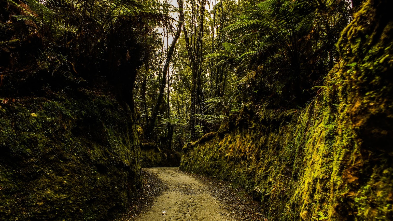
| Karangahake George |

Comments
Post a Comment